Are you and your family dreaming of taking a once-in-a-lifetime adventure to the amazing South Island of New Zealand? Then let us help you with your planning by providing the perfect 10 day South Island New Zealand Itinerary.
There are so many places to visit that it can get overwhelming. Don’t worry! We’ve created this New Zealand, South Island Itinerary 10 days perfect for your family. I am sure you’ll enjoy it. Our itinerary is a detailed 10 days loop from Christchurch and is ideal for a family adventure.
But first, why you must not miss the South Island of New Zealand?
Just take a look at any reviews of New Zealand South Island family road trips, and you will see page after page of five-star comments.
There is such an abundance of family-friendly things to see, places to go, and adrenaline-pumping adventures to be had.
This is a DETAILED day-by-day itinerary for visiting the South Island of New Zealand. We usually have more relaxed itineraries.
But it’s New Zealand. There is so much to see, and since it’s *on the other side of the world*, let’s make the most of a trip, right? It will be long, full days, but it will be fun.
Disclaimer: Just a heads up, this free article contains affiliate links. If you purchase after clicking one of these links, I may earn a small commission at no additional cost. Also, as an Amazon Associate, I earn from qualifying purchases. Your support helps me continue to provide helpful and free content for you.
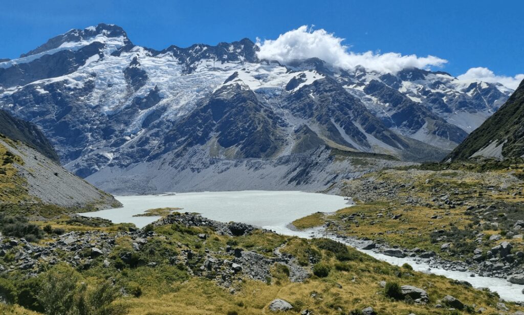
Planning a 10-Day South Island New Zealand Itinerary
Here are a few things to know when planning a road trip to South Island, New Zealand.
✈️ Book your flight to South Island. Find cheap flights to Christchurch (CHC) using Google Flights or Skyscanner, where you’ll be able to compare different airline tickets for CHC, including some low-cost ones.
🚗 Rent your car or campervan. You can rent a car directly from Christchurch (CHC) or wait until you are in town. I recommend you compare pricing on DiscoverCars. If you prefer to rent an RV, check out Outdoorsy. They have many options in South Island.
📝 Note that most car and RV companies charge a one-way fee if the drop-off location is different than the pick-up location. Keep that in mind when planning your trip.
Viator and Get Your Guide are two great websites for finding fun tours in and around South Island, New Zealand, such as the Wanaka: Combo Entry to Puzzling World and the Lord of The Rings Scenic Tour.
📱 Download a few apps to help you plan your road trip!
The GoWhee app is the perfect app for finding fun kid-friendly activities along the way. AllTrails is our app to look at trails report and see if the trail is kid-friendly.
Also, don’t forget to download Gypsy Guide audio tours to learn about the areas you’re road-tripping to while driving.
Traveling to New Zealand? Download this 10-Day itinerary to help you plan your trip.
10-Day South Island New Zealand Itinerary
Most overseas tourists doing a South Island road trip will fly into and out of Christchurch. This is why the itinerary is based on a 10-day “oop road trip from Christchurch.
📝 NOTE: If you are driving down from the North Island, you’ll arrive in Picton on the Interislander or Bluebridge ferry. You can adjust this itinerary to include an extra day from Picton to Christchurch via Kaikoura. If you are flying into and out of Queenstown, pick up the itinerary from there.
Quick Summary of Your 10 Day South Island New Zealand Itinerary
There are so many excellent options of places to go and things to see in a 10-day South Island road trip, so we have given you some extra options on each day’s outline so you can choose those best suited to your family’s ages and interests.
- Day 1: Christchurch to Lake Tekapo via the Scenic Route
- Day 2: Lake Tekapo to Omarama via Mt Cook
- Day 3: Omarama to Dunedin
- Day 4: Dunedin to Queenstown
- Day 5: Queenstown
- Day 6: Milford Sound Day Trip
- Day 7: Queenstown to Franz Josef Glacier
- Day 8: Franz Josef Glacier to Hokitika or Greymouth
- Day 9: Across Arthur’s Pass to Christchurch
- Day 10: Christchurch
If you’re thinking of exploring New Zealand in a campervan, you might want to check our post on New Zealand with a campervan Itinerary.
Day 1: Christchurch to Lake Tekapo via the Scenic Route
Total Drive Time: 3.5hrs
Total Driving Distance: 275 km (170 miles)
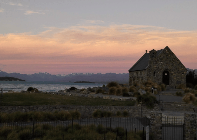
The main highway to Lake Tekapo is State Highway 1, but we recommend the more scenic route via State Highway 77. It’s only about 20 minutes longer but is a much quieter highway and a more interesting drive.
Head out of Christchurch along the Canterbury Plains- New Zealand’s largest area of flat land. It’s filled with rivers winding through and over them and miles of straight roads cutting across a patchwork of paddocks of grazing grass, wheat, and sunflowers. At the farming town of Darfield, turn off State Highway 77.
The first stop is the Rakaia Gorge, with its stunning blue-green waters. If you have time, you can do the 3 to 4-hour out-and-back walk along the Rakaia Gorge Walkway.
It’s a 10-kilometer (6.2 miles) track that follows the Rakaia River upstream along the edge of the gorge with incredible views along the way. For a shorter walk, 30 to 45 minutes each way, hike to the Rakaia Gorge Viewpoint.
The other highly recommended option here is the Washpen Falls Walk which is a suitable hike for young walkers.
The walk is a loop track and will take about 2 hours. There is a map that shows caves, volcanic rocks, swimming holes, and a beautiful waterfall.
Washpen Falls is located at 590 Washpen Road, Windwhistle.
About an hour’s drive from Rakaia, you’ll come to the town of Geraldine, famous for the family-owned Barker’s Store that is located just down the road from its original family farm.
The store sells delicious homemade preserves, jams, ice-cream toppings, and sauces. If you love cheese, there is also a very good artisan cheese shop called Talbot Forest Cheese, where you might like to sample deer cheese.
The next small town is Fairlie. A good stop for the kids is the Gem Alpaca Stud farm in Fairlie. You can do a farm tour and pet and feed the cute alpacas.
Then drive on through the tiny historic rural village of Burkes Pass up to the magnificent Mackenzie Basin and finally to Lake Tekapo.
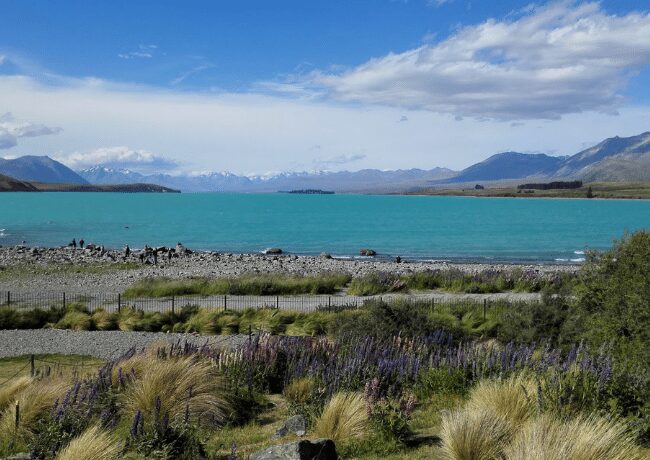
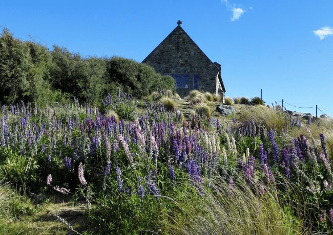
While in Lake Tekapo, take a walk around the stunning, turquoise blue, glacial Lake Tekapo, visiting the iconic Church of the Good Shepherd and the sheepdog statue.
If you’re in the Lake Tekapo area between October and January, you will see beautiful fields of very colorful lupins.
Lake Tekapo is a UNESCO Dark Sky Reserve, and one of the best places to stargaze is from a hot tub at Tekapo Springs.
You can also either walk or drive up to Saint John’s observatory for great views and join a stargazing tour if you want to see and learn more about the night sky.
👉🏻 Book your Mount Cook & Lake Tekapo Day Tour from Christchurch here!
Day 2: Lake Tekapo to Omarama via Mt Cook
Total Drive Time: 2 to 2.5 hrs
Total Driving Distance: 198 km (122miles)
Leave Lake Tekapo on SH 8 before turning right onto SH 80, also called Mount Cook Road. This road is one of the most spectacularly scenic roads in New Zealand.
It follows the edge of beautiful Lake Pukaki on its way to the stunning mountain peaks of Mount Cook National Park.
You”ll be constantly wanting to stop to take photos. A perfect place to stop is the Lake Pukaki Viewpoint on the shore of Lake Pukaki.
You’ll have Mount Cook in the background. A little further past this is the 13 km return Lake Pukaki Shoreline Walk.
In the parking area, you will also see signs for the easy 4 km Lake Pukaki Kettle Hole Walk that leads you to a kettle hole that was formed by melting glacial ice. The track has amazing views and takes about an hour. Well worth the walk!
A little further along Mount Cook Road are the huge lavender fields of NZ Alpine Lavender. Time to try the lavender ice cream!
👉🏻 Book your Tours and Tickets to Experience Lake Pukaki here!
📝 NOTE:
The fields are closed from mid-February to mid-December when the lavender is not in bloom.
Then, you’ll arrive at Mount Cook National Park.
There are many hiking options in the Mount Cook National Park, such as:
- Hooker Valley Track.
It’s one of the most popular hikes at Mt Cook. It’s an easy and flat 10 km (6.2 miles) trail that features three swing bridges that the kids will love. If you’re coming from Queenstown, you can book a ticket here.
Each bridge has stunning views of Mueller Lake, Mount Sefton, and the Mueller Glacier in the far distance.
At the end of the track is the iceberg-speckled Hooker Lake and more awesome views of Aoraki Mount Cook.
- Blue Lakes and Tasman Glacier View Track
The short walk gives views of the lower Tasman Glacier, New Zealand’s longest glacier at 27 km. But for really stunning and spectacular views, take a helicopter ride over the glaciers. It is an unforgettable experience.
Leave Mount Cook and drive back on SH 80 to the intersection with SH 8, and head towards Twizel. Twizel is a popular town for those interested in fishing, cycling, and rock and mountain climbing.
If you’re a ‘Lord of the Rings’ fan, you can book a tour of one of the filming locations for The Lord of the Rings at Ben Ohau Station, which was the backdrop for Pelennor Fields in ‘The Return of the King.’
Then make your way to Omarama. It’s at the southern end of the McKenzie Basin and is a junction town. It’s thus a perfect place to stop overnight and relax in a hot tub of crystal clear, chemical-free mountain water at the Omarama Hot Tubs.
Each tub is private with its own landscaped site. In the daylight hours, you’ll be surrounded by the magnificent Mackenzie Country Scenery, and at night you can soak in the views of the unpolluted night sky.
You may spot some glider planes soaring above as Omarama is a popular place for glider pilots, and fishermen love the area too.
Day 3: Omarama to Dunedin via State Hwy 83 and State Hwy 1
Total Drive Time: 2hrs 45 min
Total Driving Distance: 226.4 km 140.43 miles
Just 10 km (6.2 miles) outside Omarama on SH 8 is a unique attraction called the Omarama Clay Cliffs. The turn-off to the Cliffs is called Quailburn Road, and then you will drive on to the unsealed Henburn Rd.
The Clay Cliffs are like being on another planet. You’ll discover narrow ravines and tall pinnacle formations made up of layers of gravel and silt. It was formed by the flow of ancient glaciers more than a million years ago.
You can take a short walk along a well-maintained trail or venture off into the cliffs to explore. There is a donation box at the gate ($5 per vehicle), as the cliffs are on private land. Drive back from the Clay Cliffs to Omarama and take SH 83 down the Waitaki Valley, from the Mackenzie Country to the coast and Oamaru.
The highway runs along the banks of Lake Benmore and into the township of Otematata. This is the turnoff for the Benmore Dam, New Zealand’s largest earth dam. The one to two-hour Benmore Peninsula Track hike starts just up the hill from the dam in the shade of pine trees.
It’s a loop track, so it doesn’t matter which way you go, but at the fork in the track taking the left track is probably the best option as the views are more open once you get to the top of the hill.
Once you get above the tree line, the view over Lake Benmore, with its small islands and snow-covered surrounds, is beautiful.
Continue along on SH 83 to Duntroon, where there is the Vanished World Fossil Centre which is part of the National Heritage Trail network.
Kids are always fascinated with fossils, and they can check out the range of fossils that have been discovered in the region, including whales, penguins, and dolphins.
In Duntroon, you will also be able to see some amazing Maori rock art that has been drawn into the rocks to represent certain areas of Maori Culture. On SH 1, the next stop is the quaint town of Oamaru, famous for its Blue Penguin colony and its traditional Victorian precinct. You can see the world’s smallest penguins in their natural environment.
You will have to take the kids to the Rainbow Confectionery Factory Shop. It’s a factory outlet sweet/candy shop before you leave town and follow the coastline to Moeraki.
Scattered along the flat sandy Koekohe Beach near Moeraki are more than fifty huge spherical boulders of different sizes. Some are in clusters, and others are scattered separately.
Most are one to two meters in diameter, but some of them reach three meters and weigh several tonnes. The best time to see them is between low tide and mid tide, but they are visible all day long, and there is a cafe above the beach with great views too.
It’s about an hour’s drive along SH 1 from Moeraki through to Dunedin. Dunedin is the second-largest city on the South Island. It”s home to Otago University and is well known for its Scottish heritage and many historic Victorian and Edwardian buildings.
One of them is New Zealand’s only castle, the Larnach Castle & Gardens, with its New Zealand antiques, carved ceilings, stunning views, and beautiful gardens.
In the city, you can wander down George Street, eat at one of the outdoor dining spots in the Octagon, visit a museum or gallery, and check out the street art.
Visit the interesting heritage Dunedin Train Station, also known as the Gingerbread Cottage, with its mosaic floors and stained glass windows, and take a very scenic train ride to Taieri Gorge, passing through plenty of viaducts and through tunnel after tunnel.
For bragging purposes, you have to walk up Baldwin Street. It’s the steepest street in the world, although this claim to fame is being disputed by a street in Wales.
The Otago Peninsula is a must-visit destination. It is the habitat of New Zealand sea lions, fur seals, royal albatross, little blue penguins, yellow-eyed penguins, and wading birds. Visit the Royal Albatross Centre or Penguin Place.
You can visit these wildlife hotspots independently, or you might want to take one of the many wildlife tours to the peninsula to visit private wildlife habitats.
The Otago Peninsula has many bays and inlets to explore, and it is also renowned as one of the best places in New Zealand to see the Southern Lights.
👉🏻 Book your Dunedin & The Otago Peninsula Tours here!
Day 4: Dunedin to Queenstown via SH 8 & SH 6
Total Drive Time: 3 hrs 34 min
Total Driving Distance: 279 km (173 miles)
Leave Dunedin, traveling south on SH 1 through the farmland of the Taieri Plains. After about 40 minutes, you will come to the 9 square km of Lake Waihola, the country’s most inland tidal lake.
The area is recognized as a precious refuge for many threatened and endangered species of plants, fish, and birds. There are a number of picturesque walks to see the wildlife.
There is a 30 min loop walk from the Education Centre or a 2 hr walk to the Lonely and Ram Islands. There’s also a quick 10-minute Titri Creek Walk into the wetlands to see hundreds of wading birds.
Just after Milton, turn off inland on SH 8 towards Alexandra. The next town is the quaint historical gold mining town of Lawrence, where you can visit Gabriels Gully Historic Reserve, the site of New Zealand’s first major gold rush, or take the 1 hour 20 minute Gabriel Gully Walk.
Roxborough is located halfway between Dunedin and Queenstown on the banks of the Clutha River. It was an important center during the Central Otago gold rush of the 1860s and is now famous for its summer stone fruits and its amazing cycling and walking trails, such as the Roxburgh Gorge Trail and the 5-day Clutha Gold Trail or the Clutha Gold trail ride.
You must try a pie from the famous Jimmy’s Pies, who have been making their meat pies for almost 50 years. They are made from an old family recipe and are best eaten straight out of the oven!
Alexandra boomed during the late 1800s when huge gold dredges worked the Clutha River. Today it is home to orchardists and winemakers.
If you have a taste for Pinot Noir, there are a few vineyards you might want to visit on your way through.
You can also bike an old gold mining trail, and in summer and autumn, you can enjoy fresh, delicious apricots, peaches, cherries, and apples.
About 5 or 6 minutes drive further on from Alexandra on SH 8 is the smaller historic, and very picturesque town of Clyde. It is located at the entrance to the Cromwell Gorge, now flooded by the huge concrete hydro dam built near the town.
Today Clyde is a base for the cycling trails, the 150 km Otago Central Rail Trail and the Roxburgh Gorge Trail. There are walks up and around the very large concrete dam above the town with the newly created Lake Dunstan.
Then follows SH 8 onto Lake Dunstan, and you’ll know you have arrived in Cromwell when you see the large fruit sculpture before the bridge.
In the 1980s, the current town itself was built to replace the submerged parts of the original Cromwell, and the old precinct has been restored as a tourist area.
From Cromwell, you travel on SH 6, driving alongside the Clutha River, the second-longest river in New Zealand, through the Kawarau Gorge.
You’ll also pass the Goldfields Mining Centre, where you can try your luck at panning for gold.
Take a quick stop at The Roaring Meg Power Station for some excellent photo opportunities.
If you feel like you need a bit of excitement (make that a lot of excitement), stop at the Kawarau Suspension Bridge and take a leap off the bridge at the A J Hackett Bungy Centre.
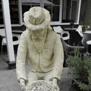
Your next stop is the beautiful little Arrowtown. The town sprung up after gold was discovered in the Arrow River in the 1860s.
The buildings on the tree-lined streets have been well preserved. You can also pan for gold here at the Chinese Mining Settlement.
There are plenty of great walks:
- Arrow River Walk gives you a 20-minute option or an hour loop walk over the footbridge.
- Tobin’s Track
- Sawpit Gully walk
If you feel like a bike ride, hire a bike or choose a cycling tour and do a 16 km (10 miles) section of the 100 km (62 miles) Queenstown Bike Trail (the Arrow Bridge Trail), which goes down the river to the Gibbston Valley, where there are a number of wineries.
👉🏻 Book your Queenstown Cycling Tour and other fun Things to Do here!
Day 5: 10 day South Island New Zealand itinerary- Queenstown
Queenstown is probably New Zealand’s most popular tourist destination. It’s located on the banks of Lake Wakatipu and is set against the magnificent Southern Alps.
A simply stunning location! 🙂
You’re going to have to be very selective about the things you choose to see and places to go. The choice is huge, ranging from adrenaline-pumping activities from bungy jumping to alpine heliskiing to beautiful hikes, and everywhere you go, you will be bombarded with those magnificent views.
Our favorite things to do around town are:
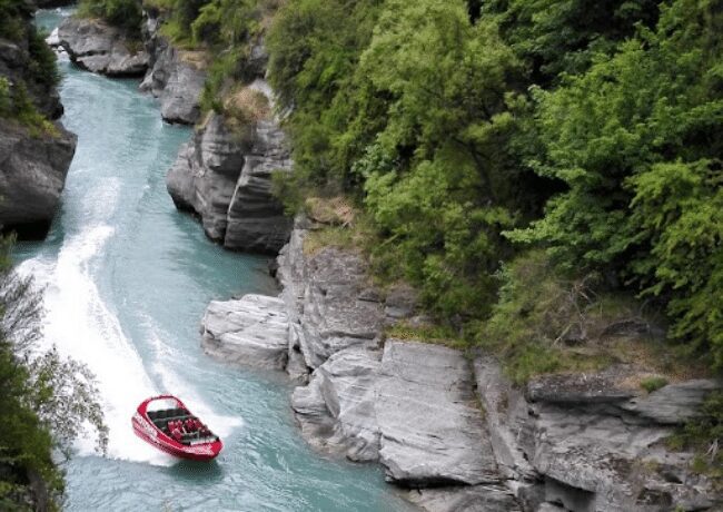
- Adrenaline-pumping jet boating, skydiving, bungee jumping, or canyon swinging
- A scenic cruise on Lake Wakatipu on the 100-year-old coal-powered TSS Earnslaw or the newer Spirit of Queenstown
- The pretty 2 km loop walk through the Queenstown Gardens
- The 5-minute gondola ride to Bob’s Peak for great views over Queenstown, Lake Wakatipu, and the Remarkables mountain range. While you’re up there, you might want to do some hang gliding, ziplining, riding the luge, or downhill mountain bike riding.
- Hungry? Fergburger advertises that they have the best burgers in the world, and Patagonia ice cream is a must. Their coffee and chocolates are pretty good too! 🙂
👉🏻 Looking for more fun things to do in Queenstown? Book here!
Then, you’ll want to save some time to visit paradise: the drive to Glenorchy.
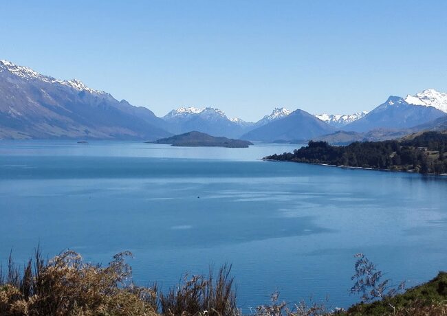
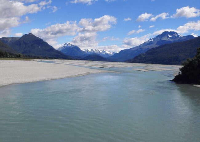
The 46 km drive to Glenorchy is a must-do while you’re in Queenstown. It is one of New Zealand’s great drives alongside the emerald-blue lake, bush-clad hills, and snow-capped mountains in the background.
There are plenty of places you’ll want to stop along the way, but our recommendations are Moke Lake, Bob’s Cove, and Mount McIntosh.
Once at Glenorchy, wander down to the wharf and take your photo at the Instagram- famous Glenorchy Railway Shed.
You’ll also want to do the easy 5 km Glenorchy Boardwalk loop track that navigates this eerie swamp-like area with breathtaking views of the Humboldt Mountains and lots of birdlife.
The Routeburn Track, one of the 10 Great Walks of New Zealand, starts not far from Glenorchy. You can hike for the first 30 minutes or so and return to get a taste of this stunning hike.
This is Lord of the Rings country, and many scenes were shot in and around Glenorchy- Isengard, Misty Mountains, Forest of Fangorn, and Ithilien Camp.
You may want to join a Glenorchy LOTR tour to find them. Parts of the area are also featured in The Lion, The Witch, and The Wardrobe, as well as ‘Prince Caspian: The Return to Narnia.’
Want bragging rights to say you’ve been to Paradise?
Paradise is at the end of a 13 km, one-way stretch of gravel road on the border of both Fiordland National Park and Mt Aspiring National Park. With no highways leading further, it’s the end of the road, and it’s Paradise!
“This is the Middle‑earth I had always pictured,” Sir Ian McKellen (Gandalf) said of Paradise.
Day 6: Milford Sound Day Trip
Total Drive Time: 3 hrs 34 min one way
Total Driving Distance: 300 km (186 miles)
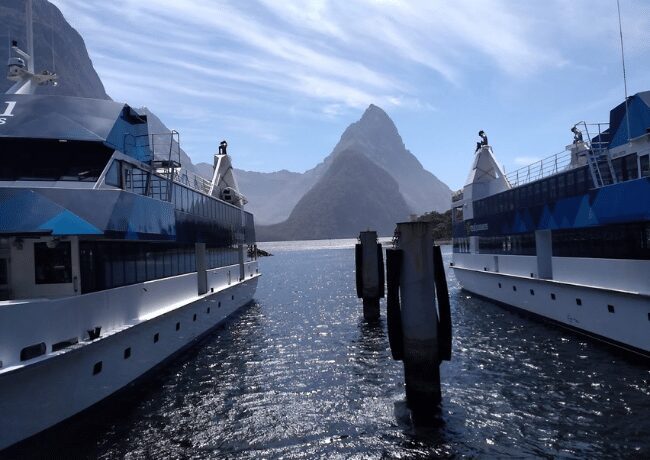
Milford Sound is, without a doubt, one of New Zealand’s most spectacular natural attractions. It’s a mesmerizingly beautiful fiord in the Fiordland National Park.
It’s known for its towering Mitre Peak and rainforests and waterfalls that plummet down its sheer sides. An interesting variety of wildlife, including fur seal colonies, penguins, and dolphins, live in and around the Milford Sounds.
There are several options for visiting it from Queenstown. The first and most expensive option is a stunningly scenic flight from Queenstown. If you can afford it in your travel budget, we certainly highly recommend it.
The next option, and the one we recommend, is to book a scenic drive and cruise tour from Queenstown. Sit back, relax, soak in the scenery, and let someone else do the driving.
The final option is to do the driving yourself. But keep in mind. It is a windy and single-lane highway and nearly 300 km one way, about a 4-hour drive each way.
There are plenty of stops along the way. Driving will give you the flexibility to stop where you want when you want, and for whatever period of time you want.
👉🏻 Book your Milford Sound Tickets & Tours here!
Day 7: Queenstown to Franz Josef Glacier
Total Drive Time: 4 hrs 36 mins
Total Driving Distance: 353 km (miles)
The drive from Queenstown to Franz Josef Glacier is one of the best drives in New Zealand. It takes around four to five hours. The road is windy and passes by lots of lakes, rivers, waterfalls, and interesting viewpoints.
From Queenstown to Wanaka, you can either take the exciting and highest main road in New Zealand, the Crown Range Road, which is known for its narrow twists, turns, and steep hills.
It’s best suited to experienced drivers. Or you can take the reliable and faster route via SH 6 back through Cromwell.
Your first stop will be the picturesque town of Wanaka. You might want to call the Wanaka Lavender Farm. They have a beautiful lavender field and a petting zoo on-site. They also have a boutique shop and café specializing in all things lavender.
Take a walk along the lakefront to #thatwanakatree – a compulsory photo is required here! The kids will thoroughly enjoy Puzzling World with its illusion rooms, an outdoor maze, tilted houses, a hall of following faces, and plenty of brain teasers that will test the sharpest minds.
👉🏻 Looking for more fun things to do in Wanaka? Check out and book your tours here!
From Wanaka, continue north along SH6 to Lake Hawea, which will be on your right, and follow the lakeside to the Neck, where you cross over to Lake Wanaka, which will be on your left.
After you pass through Makarora, you can do a short walk to the Blue Pools with their incredible white rocks and stunningly blue crystal-clear water.
A little further along are the Fantail Falls and impressive Thunder Creek Falls.
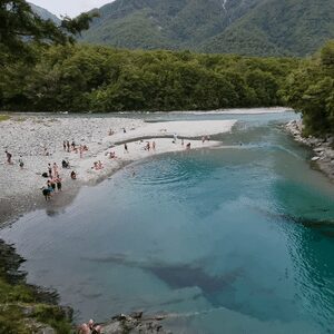
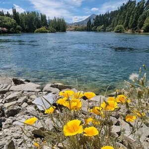
Just under a 10-minute drive from the Blue Pools is The Haast Pass Lookout. There’s a short 20-minute, 2 km return hike that leads through native beech forest to a viewpoint for the best views of Mt Aspiring National Park.
The road follows the Haast River as it grows wider, winding down towards the West Coast. As you approach Haast, you will cross the Haast River via the longest one-lane bridge in New Zealand.
Welcome to the rugged West Coast!
There are many interesting stops on the route from Haast to the Franz Josef Glacier. Here are our favorites:
- Ship Creek Walks: Signposted off SH6 are two short walks that will give you a real taste of the wild West Coast, from swamp forest to windswept sand dunes, and both walks can be done in less than an hour.
- Knights Point Lookout: At the beginning of the Haast Highway, Knights Point Lookout has spectacular views over the rugged western coastline and the Tasman Sea. You may see Elephant seals basking in the sun here.
- South Westland Salmon Farm: The Salmon Café farms the salmon on-site in four large nets just below the cafe. You can feed the fish and have your choice of salmon dishes for a tasty meal or a snack.
Fox Glacier & Franz Josef Glacier
It’s only a 25-minute drive between Fox Glacier and Franz Josef Glacier. It’s totally possible to visit the faces of both glaciers if you’re just going to look at the glaciers and not planning to do an ice walk, ice climb, or take a stunning helicopter trip.
Fox Glacier is the larger of the two. It’s one of the most accessible glaciers in the world. Its terminal face is an easy 30-minute walk from the Fox Glacier parking lot.
The equivalent walk to the Franz Josef parking lot is 5.4 km. Franz Josef is the steeper of the two glaciers.
Of the two townships, Franz Josef has more accommodation options and a wider range of restaurants. It has the Franz Josef Glacier Pools, which are a great spot to relax and rest your tired hiking legs.
There are glowworm caves along the Terrace Walk and the West Coast Wildlife Centre, where native kiwis are hatched and reared.
Fox Glacier town is the quieter of the two but gives quick access to Lake Matheson if you want to be there for the stunning sunrises.
👉🏻 For more fun things to do in Franz Josef & Fox Glacier check and book here!
Day 8: Franz Josef to Hokitika
Total Drive Time: 1 hour 39 min
Total Driving Distance: 134.2 km (83 miles)
It’s a relatively short drive from Franz Josef to Hokitika. This gives you a chance to have a longer look around the Franz Josef area in the morning if there are still things you want to see or do.
A five-minute drive north of Franz Josef is Lake Mapourika, the largest lake on the West Coast that is very popular with trout and salmon fisher-people.
You can take a guided kayak tour across the lake or a 2-hour scenic cruise.
A little further along SH6, you’ll pass Lake Wahapo and on to the Forks-Okarito Road, where you can do the short 1 km walk to the Pakihi Walk Lookout. It offers stunning views over the forest and the Southern Alps.
Follow the Forks -Okarito Road to the small coastal village (30 residents) of Okarito. The village is built on the shores of the Ōkārito Lagoon. It”s situated on a sand spit dividing New Zealand’s largest wetland and the Tasman Sea.
If you have time, take a kayak on the lagoon and spot one of the 70 species of birds that have been seen in the area, or simply soak in the views.
There are several hikes in the area too, e.g., the Wetland Walk, which is an easy 20-minute walk, starting at the Old School House and crossing the estuary on a curving boardwalk.
You’ll then drive to Hokitika. It’s a former thriving gold mining town. Today it’s known mainly for its production of greenstone and its unique festivals, one of which is the Wild Food Festival.
There are some lovely old buildings on the town’s historic walk, and there are galleries specializing in pounamu (greenstone) jewelry and artworks.
A great photo opportunity is the iconic Hokitika sign built out of driftwood on the beach, and another stunning photo opportunity is the multi-step Dorothy Falls on the eastern side of Lake Kaniere.
The 15-minute Hokitika Gorge Walk, with its bright blue water, is a good family walk. The National Kiwi Centre is a perfect spot to see not only New Zealand’s native birds but also New Zealand’s oldest reptiles, the Tuatara and Giant Eels!
Just a fifteen-minute drive from Hokitika is the West Coast Treetop Walk, with 450 meters of boardwalk that are 20 meters above the forest floor. An amazing experience!
👉🏻 Book your Hokitika tours here!
Day 9: Hokitika, Across Arthur’s Pass & Christchurch
Total Drive Time: 3 hours, 21 minutes
Total Driving Distance: 248 km (54 miles)
Leave Hokitika on SH 6 and head north for 22 km to Kumara Junction, the turn off to SH 73, and the Arthur’s Pass route to Christchurch.
Kumara is a former gold mining town. It is a key stop on the 4 or 5-day West Coast Wilderness Trail, a biking route between Greymouth and Ross.
Arthur’s Pass straddles the Southern Alps and takes you right across the South Island from the west coast to the east coast. The highest point on the route is Arthur’s Pass at 920 m.
The route has viaducts, bridges, waterfalls, and an abundance of awesome scenery as you climb up and over the pass.
Along the way, you will be following the rail route of The TranzAlpine, operated by The Great Journeys of New Zealand, from Christchurch to Greymouth. It’s a very popular train trip.
You’ll then drive over the award-winning Otira Viaduct. It’s a 445-meter cantilevered bridge that has made travel between the West Coast and Canterbury safer and faster over the last 20 years.
Otira town is almost entirely owned by one man, Lester Rowntree. He’s a self-confessed hoarder who owns 18 houses, the hotel, the dance hall, and the fire station, and is slowly building his collection of things around the town.
The small alpine village of Arthur’s Pass is the halfway point on the road to Christchurch.
A whole range of interesting hiking trails through the Southern Alps starts here, and you can get more information from Arthur’s Pass Visitor Centre.
Keep an eye out for the cheeky and mischievous Kea, the world’s only alpine parrot known for its intelligence and curiosity.
The Cave Stream Scenic Reserve is 46km from Arthur’s Pass Village. The main feature is the cave which flows underground for nearly 600 meters.
It’s about an hour’s fascinating walk, and near the inlet of the cave is a 3-meter waterfall, but please check for safety notices before you enter.
You’ve now got about an hour’s drive passing Lake Lyndon and climbing up towards Porter’s Pass.
The Porters Pass is at 939 meters, making it the highest point on the road, The Highway.
You’ll then descend into the Kowai River valley and run parallel with the river until it reaches Springfield and back onto the Canterbury Plains.
Day 10: 10 day South Island New Zealand itinerary-Christchurch
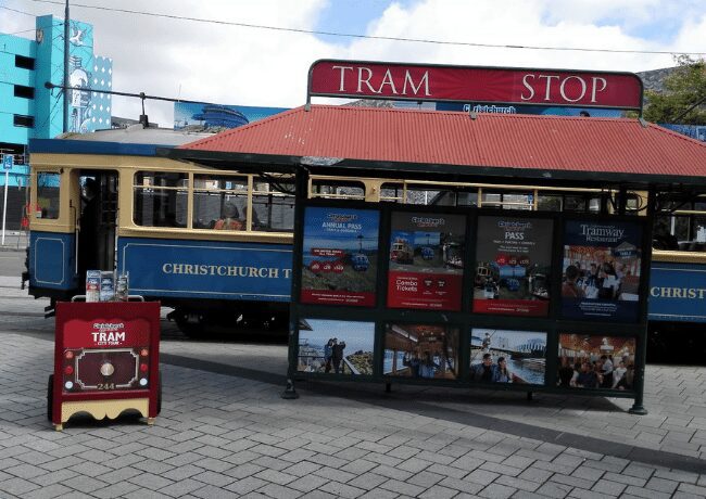
You’ll be busy trying to see everything you can in Christchurch in one day. You can buy a combined ticket for a gondola, a riverboat punt on the Avon River, and a vintage tram ride.
It’s an interesting and easy way to see around the city. The majority of Christchurch’s pre-earthquake attractions are open for business, including the must-visit Canterbury Museum.
The International Antarctic Centre near the airport is a fun place to take the kids, where they can learn about the icy continent, see live penguins, and experience -18 degrees Celsius wind chill in the storm chamber.
The French colonial settlement of Akaroa, with its 19th-century British and French colonial history, is a day trip from Christchurch, and it is where the rare Hector’s Dolphins swim.
Take a look at the Giant’s house with its colorful sculptures and mosaics, and terraced gardens.
👉🏻 Book your Christchurch tours here!
FAQ: 10 Day South Island New Zealand Itinerary
When is the Best Time to Go on a Road Trip to the South Island?
The best time for a 10-day road trip to the South Island of New Zealand is during the summer, from late October to early April. Try to avoid the Christmas/ New Year period if possible, as this is the time New Zealanders are on their annual holidays, and the school holidays from Christmas to late January are also a busy time.
How to Get Around in the South Island?
To give you the most flexibility and to take advantage of the limited time you have on a 10-day South Island road trip, we recommend either hiring a rental car or a campervan– motorhome. The choice will depend on your family’s preferences for convenience, comfort, and cost. If your budget is limited, hiring a rental car and staying at hostels, cabins at campgrounds, or motels is usually a better option financially.
How many days to road trip South Island New Zealand?
10 days are enough for the South Island, New Zealand road trip. This is because the South Island of New Zealand is relatively compact, and most of its attractions are fairly close together. The main attractions you should visit are located within a few hour’s drive of each other, so 10 days in New Zealand South Island will provide enough time to explore many of the island’s highlights without having to rush from place to place.
What is the best way to tour the South Island NZ?
The best way to tour the South Island of New Zealand is by car. Renting a car and driving the island allows you to explore and see more beauty of South Island at your own pace. Stop wherever you like and take in all the sights without being tied to a specific schedule. Plenty of roads connect all of the highlights, so it’s easy to customize your trip to your interests. There are plenty of campgrounds for those looking for a more rustic experience, or you can stay in one of the many charming towns.
Can you drive to South Island New Zealand?
Yes, it is possible to drive to South Island, New Zealand. Driving from North Island to South Island is a popular option for people visiting New Zealand and can be done by taking a ferry across Cook Strait. To begin your journey, you must take the Interislander Ferry from Wellington on the North Island to Picton on the South Island. The trip takes 3 hours and 30 minutes.
Is New Zealand North or South Island better?
Each island has unique attractions and experiences, so it really depends on the individual’s preferences when deciding which one they prefer. For instance, if you enjoy exploring nature and wildlife, the South Island may be better because it offers various scenic landscapes with wildlife reserves, national parks, and indigenous species. If you prefer urban living with cities providing entertainment and shopping, then a road trip to North Island may be more suitable for you. Both islands offer something great and exciting to explore; it just depends on what type of experience you’re looking for.
Final Thoughts on a 10 Day South Island New Zealand Itinerary
To wrap it up, South Island in New Zealand is a stunning destination for a family road trip. You’ll discover incredible views, astonishing wildlife, and plenty of fun activities, especially for kids, to keep them entertained and create lasting memories with your family or friends.
Visit the glaciers, ski at Queenstown, or explore the alpine forests – you won’t be disappointed!
Regardless of what you decide to do on your New Zealand, South Island itinerary 10 days journey, there’s no doubt this is one road trip you’ll never forget.
Good Luck, and enjoy your 10-day South Island itinerary! 🙂
We have not been able to include all the places we would love you to see on the South Island on a 10-day road trip. If you do manage to get back to New Zealand again or manage to extend your time, we suggest you also include the following places on your itinerary.
- Marlborough Sounds
- Nelson
- Hanmer Springs
- Kaikoura
- Stewart Island
- The Catlins
✍🏻 This post was written by Maureen Spencer
Maureen is a travel writer lucky enough to be living in New Zealand and has a great passion for travel. Since she became “empty nested” in the late 1990s, she has traveled and worked in over 70 countries! Now she writes articles to share her amazing experiences with other travelers in the hope of providing practical information to help them to prepare and plan for their travel trips.
Related Articles
If you enjoyed this article, you might also like to read the following articles:
