You may have heard many people saying to just skip the Prairies when road tripping across Canada since it’s flat … and boring. But I am telling you “You should NOT as you would miss some cool hidden gems in Saskatchewan.”
And to prove it to you, I’ve created this amazing 6-day itinerary for a Saskatchewan road trip.
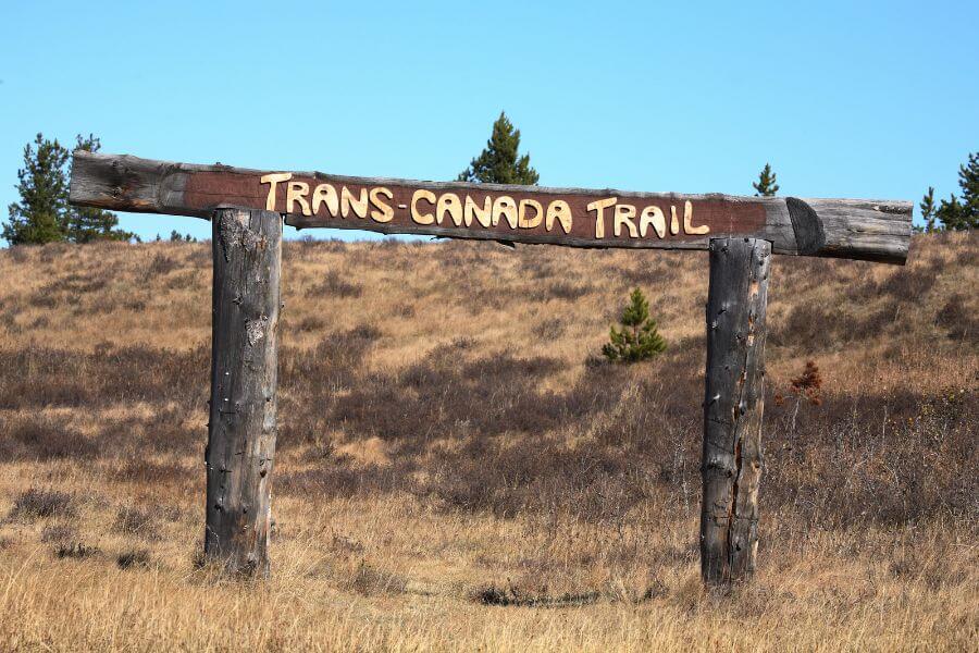
But in order to see all those unique places in Saskatchewan, you have to get out of the Trand-Canadian highway and explore Southern Saskatchewan.
Traveling to Canada? Get your Canada Road Trip Guide for Families
Disclaimer: Just a heads up, this free article contains affiliate links. If you purchase after clicking one of these links, I may earn a small commission at no additional cost. Also, as an Amazon Associate, I earn from qualifying purchases. Your support helps me continue to provide helpful and free content for you.
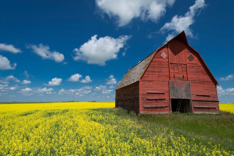
Hidden Gems in Saskatchewan: A 6-day road trip from Moose Jaw to Medicine Hat
Here is a Saskatchewan road trip itinerary from Moose Jaw to Medicine Hat (AB). You’ll be exploring Moose Jaw, then head off the Trans-Canada highway to discover Southern Saskatchewan and its hidden gems.
You’ll visit a French town, a national park, ghost towns, an historic fort, an archeological site and so much more.
Are you ready?
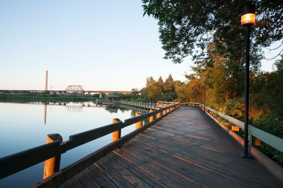
Day 1: Moose Jaw
Spend your first day exploring Moose Jaw.
Wakamow Valley
Start the day at Wakamow Valley just outside Moose Jaw historic center. Wakamow Valley is located along the Moose Jaw River, and it covers over 550 acres.
There are over 20 km of hiking and walking trails. Some of the most popular trails in the park include:
- the River Park Trail: 2.4 km
- the Plaxton’s Lake Trail: 2.1 km
You can find the map of the trail system here.
In addition to hiking, Wakamow Valley is also an excellent place for birdwatching. The park is home to a wide variety of bird species, including eagles, ospreys, great blue herons, and more. There are several lookout points throughout the park where you can stop and observe the birds in their natural habitat.
Tunnels of Moose Jaw
Then, head to Historic Moose Jaw and join one of the Tunnels of Moose Jaw tours. During the tours, you’ll walk through a network of tunnels that were once used as a hideout for:
- rum runners during Prohibition,
- a place to smuggle Chinese immigrants into Canada, and
- a training ground for Canadian soldiers during World War II.
There are two different tours available:
- the “Chicago Connection” tour: This tour focuses on the city’s connections to the American mob during Prohibition
- “Passage to Fortune” tour. This tour tells the story of Chinese immigrants who were smuggled into Canada through the tunnels.
Both tours are suitable for families with young children, but some parts of the tour may be a bit scary. The tours are conducted in underground tunnels, so visitors should be prepared for some low ceilings and narrow passageways.
Moose Jaw Trolley
End your day on the Moose Jaw Trolley to explore the town and its history.
The trolley is a replica of an old-fashioned streetcar. It takes visitors on a 45-minute guided tour of the city’s main attractions.
Don’t like guided tour? Why not take a Moose Jaw Audio Walking Tour.
The tour begins at the Moose Jaw Visitor Centre and will take you around the city’s historic downtown area including:
- the Tunnels of Moose Jaw,
- the Murals of Moose Jaw, and
- Crescent Park.
The Moose Jaw Trolley runs from May through September and operates daily except for Mondays.
🛏️ Where to stay in Moose Jaw
Temple Garden Hotel & Spa: It’s a nice hotel with an indoor and outdoor geothermal natural pools. It offers a complimentary breakfast
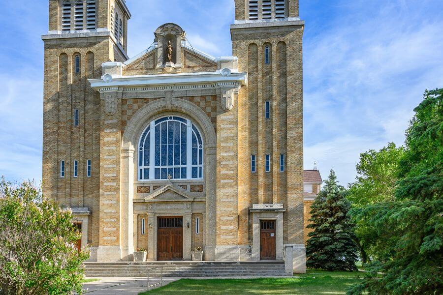
Day 2: Moose Jaw to Gravelbourg
Slowly make your way from Moose Jaw to Gravelbourg. The overall drive is 117 km.
Old Wives Lake Nature Area
Make a first stop at Old Wives Lake Nature Area. It’s a designated migratory bird sanctuary home to a wide variety of birds, including waterfowl, shorebirds, and songbirds.
Walk the Prairie Trail. It’s a self-guided, 2.4-km walking trail where you’ll walk through grassland and wetland. Then, enjoy the lake and the beach. It has shallow water and a sandy shoreline.
Gravelbourg
When you’re ready, drive to Gravelbourg. The town is known for its rich Francophone history and cultural heritage. It’s one of the places to visit in Saskatchewan.
In Gravelbourg, visit the Our Lady of the Assumption Co-Cathedral. The cathedral features murals that tell the story of the town’s French-Canadian and Métis heritage. You can even do a guided tour.
Then, take a self-guided Heritage Walking tour and end your day with a dinner at Cafe de Paris.
🛏️ Where to stay in Gravelbourg
There are not many options in Gravelbourg. You can stay at Heritage Place Hotel
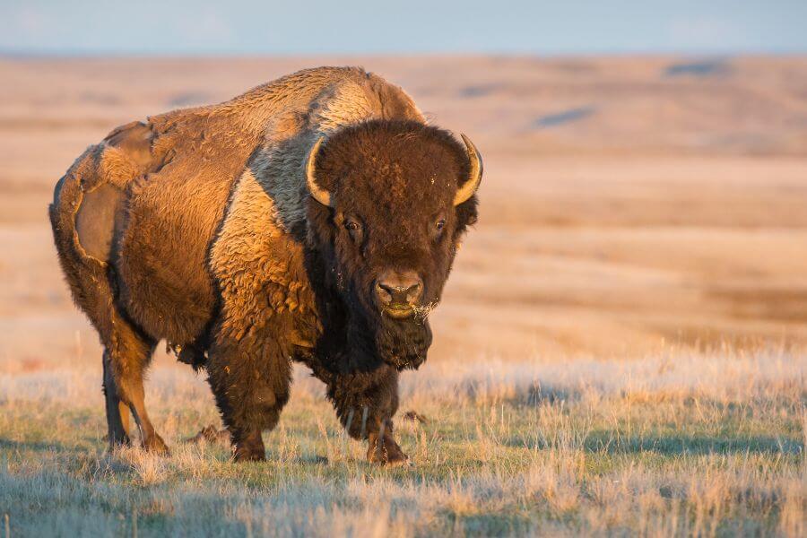
Day 3: Gravelbourg to Grassland National Park
Drive from Gravelbourg to Grassland National Park (156 km).
Thomson Lake Regional Park
Leave early and stop at Thomson Lake Regional Park. You can enjoy the large sandy beach. It’s perfect for swimming and sunbathing. There is a playground with swings and slides for the kids to enjoy.
Grassland National Park
Then, enjoy the rest of the day at Grassland National Park. This park shows the unique landscape of the prairie grasslands of the Great Plains.
As soon as you enter the park, stop at the Visitor Center to get the Xplore booklet for the kids.
Start your visit to this national park with the 20-km Ecotour Scenic Drive in the West Block. On this self-driving tour, you can see the herd of Prairie bison. You might also get to so pronghorns and coyotes
Don’t miss the Top Dogtown Trail at pull-off #2 of the Ecotour Scenic Drive. It’s an easy 0.75 loop. You’ll probably see lots of little prairie dogs.
But remember to put lots of sunscreens and bring a hat because there is no shade. It can get really hot in the summer.
End your day with the Eagle Butte Trail hike. It’s an easy 2.0-km loop trail where you can see wildflowers, such as:
- crocus,
- prairie onion,
- cinquefoil,
- rose,
- vetch,
- locoweed,
- violets
Throughout the trail, you’ll find interpretive panels describing prairie vegetation, human history and geology.
🛏️ Where to stay near Grassland National Park
You can find a campsite at the National Park campground or find a inn in Val Marie.
Day 4: Grassland National Park to Cypress Hill Interprovincial Park
Drive from Grassland National Park to Cypress Hill Interprovincial Park (292 km).
Grassland National Park
Wake up early and head back into Grassland National Park, but this time in the East Block. Drive along the Badland Parkway. It’s a 12-km scenic drive. There are six unique viewpoints overlooking the grasslands and badlands of Rock Creek.
Ghost Towns of Saskatchewan
Then, drive to Robsart and Govenlock on Highway 13 to find some of the most unique places in Saskatchewan. The road is known as the Ghost Town Trail. From Wauchope and Govenlock, there are 32 ghost towns. Some towns only have a commemorative plaque, but others have remains of buildings.
In Robsart, you can wander around the few blocks square of the old community and see many historical buildings and houses. In Govenlock, you can see many cement foundations and wooden sidewalks around the town site. But the only building that still stands is the old community hall. There is also a commemorative plaque in remembrance of Govenlock’s rich history.
Cypress Hill Interprovincial Park
When you are ready, continue driving to Cypress Hill Interprovincial Park. The park is home to over 220 bird species, 47 mammal species, and 24 species of reptiles and amphibians. Cypress Hill Provincial Park really is a hidden gems of Saskatchewan. It’s one of the largest dark sky perverse in the world.
In Cypress Hill, explore the Center Block. You can hike the Whispering Pines Trail. It’s a 2.7 km loop where you’ll walk through mature lodge pole pine forest. Note that it can be hard to find the trailhead since there is no signage.
Then, enjoy Loch Leven Lake. It’s perfect for paddle boarding. The Loch Leven Lake offers rentals for :
- canoe,
- kayak,
- paddleboat,
- paddleboard,
- mountain bike,
- fishing equipment
🛏️ Where to stay in Cypress Hill Provincial Park
Cobble Creek Lodge in Maple Creek: It offers a free continental breakfast. You can also stay at The Resort at Cypress Hill.
Day 5: Cypress Hill Provincial Park to Medicine Hat
Drive from Cypress Hill to Medicine Hat (168 km).
Fort Walsh National Historic Site
Start your day early and head to Fort Walsh National Historic Site in the West Block. Fort Walsh was established in 1875 by the North-West Mounted Police (NWMP). It was created for the fur trade in the area and to maintain peace between First Nations and settlers. It’s also at Fort Walsh that Treaty 6 and Treaty 7 were signed.
Make sure to take a guided tour of the fort to learn about its history and the role of the NWMP in Canadian history. The tours include visits to the barracks, stables, and other historic buildings on the site.
The site also offers a range of living history programs that allow visitors to experience what life was like at the fort in the late 19th century including demonstrations of blacksmithing and cooking.
Elkwater Lake
After your visit to Fort Walsh, drive to Elkwater Lake and enjoy the lake.
You can also find a few hiking trails such as the Rodeo Loop Trail. It’s a 2.2-km hiking trail. You can also do the Elkwater Lookout trail. It’s a 3.9-km out-and-back trail. Both are beautiful forest trails.
Then, drive to Medicine Hat where you can relax for the rest of the evening.
🛏️ Where to stay in Medicine Hat
Medicine Hat Lodge, Trademark Collection by Wyndham: This hotel has a pool with a waterpark, which is perfect for kids.
Day 6: Medicine Hat
Explore Medicine Hat on your last day.
World’s Tallest Teepee
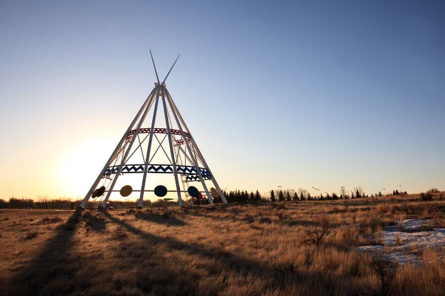
Start your day at the World’s Tallest Teepee. The teepee was originally constructed for the Calgary 1988 Winter Olympics. It is 65.5 meters (215 feet) tall, making it one of the tallest structures in Canada.
The teepee is a symbol of the First Nations people who have lived in the Medicine Hat area for thousands of years. It represents the traditional shelter of the Plains Cree people and serves as a reminder of their cultural heritage. Each of the 10 masts features a large storyboard depicting aspects of native culture and history.
Then, look at the Saamis Archaeological site. Between 1390 and 1820 A.D, the site was a campsite for the winter and early spring seasons for the Saamis first nation group. This area provided excellent campsites for processing bison meat, and it was rich in water, shelter, and a variety of plants and animals.
Devonian Trail
In the afternoon, walk or bike along the river on the Devonian Trail. The Devonian Trail is a 6.3-km out-and-back multi-use trail along the South Saskatchewan River. It starts at Strathcona Island Park where you can find picnic areas and kids’ playground.
If you have a bike or want to rent some, Devonian Trail is the perfect trail for a family bike stroll.
Medicine Hat Sunshine Trolley
End your day on the Medicine Hat Sunshine Trolley. It’s a hop-on, hop-off type of bus tour with commentaries. It starts at the Visitor Information Center and stops in many places such as:
- Saamis Tepee
- Kiwanis Central Park,
- Medicine Hat’s Historic Downtown and Esplanade Arts & Heritage Centre.
- Medalta in the Historic Clay District,
- Strathcona Island Park
F.A.Q Saskatchewan Road Trip
What wildflowers are in Grasslands National Park?
There are a lot of different types of wildflowers in Grasslands National Park including: Crocus, prairie onion, cinquefoil, rose, vetch, locoweed, violets, asters, fleabanes, goosefoot, and buttercups.
Why are there so many ghost towns in Saskatchewan?
Many of the ghost towns in Saskatchewan were once thriving communities that developed along railway lines. When the railway lines were rerouted or abandoned, the towns lost their main source of transportation and commerce, leading to their decline and eventual abandonment.
Also, Saskatchewan has experienced several droughts and environmental challenges throughout its history, which have contributed to the decline of many communities.
What is unique about Cypress Hills Interprovincial Park?
Cypress Hills Interprovincial Park is one of the highest points of land between the Rocky Mountains and Labrador, with an elevation of over 1,400 meters. This elevation creates a unique climate and diverse landscape that is different from the surrounding prairie.
Also, Cypress Hills Interprovincial Park is one of the largest Dark Sky Preserves in the world.
Is Cypress Hills in Alberta or Saskatchewan?
Cypress Hills is located at the border of Alberta and Saskatchewan making the park the first interprovincial park in Canada.
How long does it take to drive across Saskatchewan?
It takes about 640 km to drive across Saskatchewan, from east to west along the Trans-Canada highway.
Does Saskatchewan have mountains?
Yes. Saskatchewan has mountains. It has 137 named high points. The highest point is the Saskatchewan High Point (1,392m/4,566ft) and the most prominent point is Brockelbank Hill (814m/2,617ft).
Is it worth going to Saskatchewan?
Yes, it is worth going to Saskatchewan. I would recommend exploring outside the main Trans-Canada highway. There are many unique places to visit in Saskatchewan, especially in Southern Saskatchewan such as national parks, ghost towns, lakes and badlands.
Final Thoughts: Hidden Gems in Saskatchewan
There are so many hidden gems in Saskatchewan that you’ll want to take your take and not hurry to Alberta. Take your time, get out of the Trans-Canada highway and explore all the unique places Saskatchewan has to offer.
Related Articles
- 13 Best Places to Go Camping in Canada with Kids
- Driving Across Canada Tips for an Epic Family Road Trip
